Showing posts with label Tourist Spots. Show all posts

Bohol


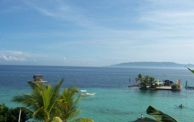
Bohol is a popular tourist destination with its beaches and resorts. The Chocolate Hills, numerous mounds of limestone formation, is the most popular attraction. The island of Panglao, located just southwest of Tagbilaran City, is home to some of the finest beaches in the country. The Philippine Tarsier, considered by some to be the smallest primate, is indigenous to the island.


Boholanos refer to their island homeland as the 'Republic of Bohol' with both conviction and pride. A narrow strait separates the island of Cebu and Bohol and both share a common language, but the Boholanos retain a conscious distinction from the Cebuanos.

Hills dominate the island of Bohol. Two ranges run roughly parallel on the northwest and the southeast. An interior plateau is dominated by limestone hills. In Carmen, Batuan and Sagbayan, these hills form near perfect cones in great numbers and are collectively referred to as the Chocolate Hills.

Bohol's climate is generally dry, with maximum rainfall between the months of June and October. The interior is cooler than the coast. Bohol is the home province of Carlos P. Garcia, the fourth president of the Republic of the Philippines (1957-1961) who was born in Talibon, Bohol.

Geography


The Island of Bohol is oval-shaped mainland surrounded with 73 smaller islands, having a gently rolling terrain, ideal for commercial and industrial site development. Bohol's mountainous interior is home to rare and endangered flora and fauna. At certain points, hills drop steeply to the coast from a maximum elevation of 870 meters above sea level. The interior uplands are fit for agro-forestry and high value agricultural production. The central and northern lowlands have also fertile grounds and abundant water supply. Over a hundred caves have been identified, the biggest of which is found in the eastern part which makes Bohol ideal for spelunking adventures.[17] The Chocolate Hills in Carmen, Bohol are considered one of Philippine's natural wonders and Bohol is often referred to as the Jewel of the Philippines. They are hills made of limestone leftover from coral reefs during the ice age when the island was submerged. They turn brown during the summer, hence their name.

Most beaches are of white sand. The sand is often of such high quality that it is exported to other beaches in the world. The most well known of these beaches are in Panglao Island, and there, numerous islets have similar, yet untouched and pristine beaches.The Loboc River is the most famous, running from the southeastern coast to the center of the island. It is famous for its River Cruise going up to its water source. The largest, Inabanga River, runs in the northern part of the province.

Numerous waterfalls and caves are scattered across the island, including the beautiful Mag-Aso falls in Antequera. Mag-Aso means smoke in the native tongue. The water is cool and often creates a mist in humid mornings which can hide the falls. Panglao is a small island southwest of the main island, connected by a causeway to Tagbilaran.

Climate


Unlike Luzon and the northern part of Visayas, Bohol is mostly unaffected by the numerous typhoons that hit the country. The weather is mostly mild all year round. When typhoons do hit the island, they usually cross quickly and are no longer powerful, their energy dissipated by the mountains in Leyte and Samar.

From November to April, the northeast monsoon (amihan) prevails. Except for a rare shower, this is the mildest time of the year. Daytime temperatures average 28°C, cooling down at night to around 25°C. The summer season from May to July brings higher temperatures and very humid days. From August to October is the southwest monsoon (habagat). The weather during this season is not very predictable, with weeks of calm weather alternating with rainy days. It can rain any day of the year, but you will have more chance for a heavy shower from November to January.


Siargao


It has a land area of approximately 437 square kilometers. The east coast is relatively straight with one deep inlet, Port Pilar. The coastline is marked by a succession of reefs, small points and white, sandy beaches. The neighboring islands and islets have similar landforms.

Geography


Siargao Island contains the largest mangrove forest reserves in Mindanao, at Del Carmen. Long stretches of wetlands indicate a potential for commercial seaweed propagation. Siargao Island is greatly influenced by the winds and currents coming uninterrupted from the Pacific Ocean, intensified by the Mindanao current running westward through the Siargao Strait.

Siargao Island is situated at a coordinate of 9°52′N, 126°03′E. It composed of municipalities of Burgos, Dapa, Del Carmen, General Luna, San Benito, San Isidro, and Santa Monica.

Offshore, a classic tropical island lies protected within its surrounding coral reef with dozens of coconut palms dressed in the center circle of the island. Off to the right, well within the massive coastal reef, lies a shining white sand bar, (Pansukian, or Naked island) some 200 meters long. The tide of Siargao is diurnal with tidal curves typically present, especially on the east coast of the island.

The Island's Pacific-facing reefs are situated on the edge of the Philippine Trench, and the extremely deep offshore waters assure the ocean swells have undiluted power when they encounter the many coral and rock reefs. Siargao has excellent surfing conditions, particularly during the southwest "habagat" monsoon from August to November, when the prevailing wind is offshore.

Cloud 9


One of the best known surfing waves on Siargao and the Philippines, with a worldwide reputation for thick, hollow tubes is "Cloud 9". This right-breaking reef wave is the site of the annual Siargao Cup, a domestic and international surfing competition sponsored by the provincial government of Surigao del Norte.

The wave was discovered by travelling surfers in the late 1980s. It was named and made famous by American photographer John S. Callahan, who published the first major feature on Siargao Island in the United States- based Surfer magazine in March 1993, and hundreds of his photos in many other books and magazines since his first visit in 1992. Callahan has put the island on the international map and has drawn thousands of surfers and tourists to Siargao. Cloud 9 also has a reputation for being a relatively cheap destination for surfers with many cheap accommodations and restaurants and bars to choose from.

There are several other quality waves on Siargao and nearby islands, but Cloud 9 has received more publicity than any other, indeed in the Philippines as a whole. It is the only wave easily accessible without a boat, leading to overcrowding and the nickname of "Crowd 9" among surfers worldwide. Eager foreign and locally owned accommodation and tourist facilities have profited from the magazine publicity and the influx of visitors drawn by the annual Siargao Cup competition in September.

Siargao is well known as "The Surfing Capital of the Philippines" with a reputation among surfers within the Philippines and the International scene.

Eddie Florano has also written a song called Surfin' in Siargao from 'Ukulele World: Acoustic & Power Ukulele' album (2006).

Tagaytay


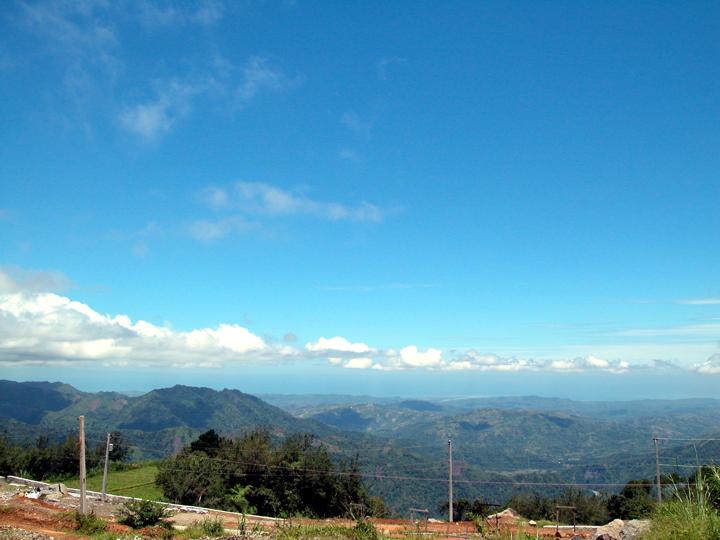
Tagaytay City lies on top of the Tagaytay Ridge, which, at 640 meters above sea level, is the highest point in Cavite. The ridge provides a spectacular view of Taal Lake and Taal Volcano in Batangas. This view supports Tagaytay's main industry, which is tourism.


Location


Tagaytay City is located in the Province of Cavite, on the island of Luzon, approximately 56 kilometer south of Manila. It lies within 120° 56' longitude and 14° 6' latitude and overlooks Manila Bay on the North, Taal volcano and Taal lake on the south and Laguna Bay on the east.

The City is linked by the national highway to the Metropolitan Manila Area and to the Province of Batangas. It is also connected by the roads to the adjoining municipalities of Amadeo, Mendez, Indang, Silang and Alfonso in Cavite towards the northwest, to the cities of Calamba and Sta. Rosa in Laguna in the northeast and to the town of Talisay in Batangas in the south.


Tourism


The city of Tagaytay is a tourist attraction for local and foreign visitors. It is an excellent vantage point of Taal Lake and Volcano. Tagaytay offers a breathtaking sight of the famous Taal Lake - a lake within an island within a lake.

Tagaytay City has vast resources and possesses tremendous potentials for development in tourism and agriculture. It is envisioned to become a city that is enriched and comfortable to live in and visit, with flowers in bloom along roadsides, ridges and mountains swathed in green, pure and unpolluted air and climate always invigorating. Tagaytay is a perfect getaway for people seeking respite from the daily pressures of life in the metropolis. It is home to more than 60 convents and congregations and numerous hotels, resorts, and convention centers. Lush forests, open grasslands and gentle slopes make up a calm scene that pleases and refreshes the eye - conducive for meditation and concentration needed during training, conventions and retreats.

Tagaytay’s three anchors of growth are tourism, agriculture and the development of the City’s institutions. The City’s inherent environmental splendor and unique rustic atmosphere, made possible by Tagaytay’s Nature-given endowments and fresh cool air, has fueled it to its present state of growth. Careful implementation of land use policies is being undertaken to protect the city’s agricultural sector. The community aims to sustain a strong ecological-tourism base with ample physical and social infrastructure system support. Tagaytay is a city in transition. There is a fundamental shift occurring in the City’s economic structure from an agro-based to a service-oriented community. The current business trend in Tagaytay is the construction of exclusive weekend residential and recreational activities.

Temperature


Tagaytay City's climate is characterized by relatively low temperature, low humidity and abundant rainfall. The City is endowed with a cool and invigorating climate with an average temperature of 22.7 °C. Situated approximately 600 meters above sea level, the city is misty and is relatively cooler during the months of December, January and February. Like most areas in the Province of Cavite, the city has two pronounced seasons: dry from November to April and wet during the rest of the year. The climate has made the city very ideal for sports, picnics, conferences, honeymoons, country homes, and spiritual retreats.

Baguio


City of Baguio is a highly urbanized city in northern Luzon in the Philippines. Baguio City was established by Americans in 1900 at the site of an Ibaloi village known as Kafagway. Baguio City was designated by the Philippine Commission as the Summer Capital of the Philippines on June 1, 1903 and incorporated as a city by the Philippine Assembly on September 1, 1909. There is a presidential mansion, as well as supreme court and legislative offices in Baguio. Baguio is the seat of government of the Cordillera Administrative Region. The name of the city is derived from the word bagiw in Ibaloi, the indigenous language of the Benguet Region, meaning 'moss'. The city is at an altitude of approximately 1500 meters (5100 ft) in a moist tropical pine forest conducive to the growth of mossy plants and orchids.

History


The region around Baguio was first settled by the Cordillerans, primarily the Kankane-y, Ibaloi, and Itogon tribes. In nearby La Trinidad, Spaniards established a commandante or military garrison, although Kafagway, as Baguio was once known, was barely touched. In 1901 Japanese people and Filipinos commanded by the Americans in engineering built Kennon Road, the first road directly connecting Kafagway with the lowlands of Pangasinan. Before this, the only road to Kafagway was Naguilian Road. On September 1, 1909 Baguio was declared a chartered city. The famous American architect Daniel Burnham, one of the earliest successful modern city planners, laid a meticulous plan for the city. His plan was, nevertheless, realized only to a small extent, primarily due to lack of political will among the leaders who served for the city from the pre-war Baguio to the present. Americans declared Baguio the Summer Capital of the Philippines and The Mansion as the residence of the American governor-general to escape Manila's Summer heat. Americans further developed Baguio, building parks and public structures such as Wright Park in honor of Governor General Luke E. Wright, Burnham Park in honor of Baguio city planner Daniel Burnham, Governor Pack Road, Session Road, Assumption Road.

Baguio is well known as site of the surrender of General Tomoyuki Yamashita and Vice Admiral Okochi. It is where they gave up the entire Imperial Japanese Armed Forces to American authorities at the High Commissioner's Residence in Camp John Hay on September 3, 1945, marking the end of World War II.

With Philippine independence in 1946, Americans settled in the city and English became the primary lingua franca. Ilocanos joined the Cordillerans in Baguio, and the population of Americans, Dutch, Belgians, and Germans soared.

An large earthquake destroyed most of Baguio on July 16, 1990. The city was quickly rebuilt, thanks to the aid of national government and various international donors like Japan and other nations.

Around May 2003, a petition initiated by Dion Fernandez to declare Baguio a heritage zone was circulated on the Internet and national print media, gaining more than 10,000 signatures. The petition calls upon unspecified officials to create the Zone prior to the Baguio centennial in 2009. In May 2005, the Heritage Conservation Society submitted to the Baguio City Council a proposed Special Heritage Bill drafted by HCS Trustee Ivan Henares. It has been approved on second reading but is being opposed by a group of businessmen.


Economy


The economy of Baguio City is centered on its educational institutions, of which it has in excess of seven colleges and universities as well as a plethora of trade and technical schools. Estimates are that these schools comprise at least one hundred thousand students.

Another key source of income for Baguio is its character as the commercial hub in the province of Benguet. Many of the agricultural and mining goods produced in Benguet go to Baguio City for processing and central distribution.

The city is also a major retail center for the Cordilleras and Ilocos provinces, with shoppers coming to the city to take advantage of the diversity of competitively priced commercial products on sale, many of which would only be available in Manila. Despite the city's relatively small size, it hosts numerous shopping centers and malls catering to the increasing commercial and tourist activity in Baguio: these include SM City Baguio mall, Baguio Center Mall, Cooyeesan Hotel Plaza, Abanao Square, Maharlika Livelihood Center, and Porta Vaga Mall.

Various food and retail businesses run mby local residents proliferate, serving to form what has become a part of Baguio's local cultural landscape. Some of these include the Tiong San chain of department stores and supermarkets, Sunshine Supermarket, Star Cafe, Country Mart, the famous Rose Bowl Restaurant and many others.

The areas of Session Road, Harrison Road, Magsaysay Avenue and Abanao Street comprise the trade center of the city. It is in these areas where commercial and business structures abound. First-class cinemas, hotels, restaurants, department stores, and shopping centers are to be found in this area. Shopping at the famous City Market offers one a wide array of locally sourced goods and products: everything from colorful woven fabrics and hand-strung beads to primitive wood carvings, cut flowers, strawberries and "Baguio" vegetables, the latter often denoting vegetable types that do well in the cooler growing climate. (Strawberries and string beans—referred to as 'Baguio beans' across the Philippines—are shipped to major urban markets across the archipelago.)

Baguio is also home to one of the country's most profitable Philippine Economic Zone Authority areas (PEZA), called the Baguio City Economic Zone (BCEZ), located in the southern part of the city between the Camp John Hay leisure resort and the Philippine Military Academy. Firms located in the BCEZ mostly produce and export knitted clothing, transistors, small components for vehicles, electronics and other computer parts. Notable firms include Texas Instruments Philippines, MOOG, and Sitel. Recently, there has been an influx of call centers in the city with American companies outsourcing their technical support facilities in the country.

Tourism is one of Baguio's main industries. Commonly, overseas visitors pass through Baguio, while Filipinos make it a destination.

Boracay


Boracay is a tropical island located approximately 315km (200 miles) south of Manila and 2km off the northwest tip of the island of Panay in the Western Visayas region of the Philippines. It is one of the country's most popular tourist destinations. The island comprises the barangays of Manoc-Manoc, Balabag, and Yapak (3 of the 17 barangays which make up the municipality of Malay), and is under the administrative control of the Philippine Tourism Authority in coordination with the Provincial Government of Aklan.


Geography


Boracay Island is located off the northwest corner of the island of Panay, and belongs to the Western Visayas island-group, or Region VI, of the Philippines. The island is approximately seven kilometers long, dog-bone shaped with the narrowest spot being less than one kilometer wide, and has a total land area of 10.32 square kilometers.

South-facing Cagban Beach is located across a small strait from the jetty port at Caticlan on Panay island, and the Cagban jetty port serves as Boracay's main entry and exit point during most of the year. When wind and sea conditions dictate, east-facing Tambisaan Beach serves as an alternative entry and exit point.

Boracay's two primary tourism beaches, White Beach and Bulabog Beach, are located on opposite sides of the island's narrow central area. White Beach faces westwards and Bulabog Beach faces eastwards. The island also has several other beaches.

White Beach is the main tourism beach. It is a bit over four kilometers long and is lined with resorts, hotels, lodging houses, restaurants, and other tourism-related businesses. In the central portion, for about two kilometers, there is a footpath known as the Beachfront Path separating the beach itself from the establishments located along it. North and south of the Beachfront Path, beachfront establishments do literally front along the beach itself. Several roads and paths connect the Beachfront Path with Boracay's Main Road, a vehicular road which runs the length of the island. At the extreme northern end of White Beach, a footpath runs around the headland there and connects White Beach with Diniwid Beach.

Bulabog Beach, across the island from White Beach, is a secondary tourism beach and Boracay's main windsurfing and kiteboarding area.


Accomodation


A number of accommodation types are scattered all over the island, ranging from luxurious hotel types to budget, spartan rooms. Guests can also choose according to location--Station 3 is where most of the cheaper lodgings are located, while Station 2 is meant for those who want to be within close proximity of the bars. Station 1, meanwhile, is where you can find the more isolated accommodations, offering peace and quiet to those looking for a respite from the usual action-packed Boracay night scene. These are usually for the more upscale vacationers.

Boracay is the site of a world-class 18-hole par 72 golf course designed by Graham Marsh. In addition, Boracay now has in excess of 350 beach resorts with more than 2,000 rooms ranging in quality from five-star to budget accommodations, so tourists are sure to find whatever they are looking for.

Boracay also offers a wide range of restaurants, bars, pubs, and nightclubs that bop until morning.


Events


Boracay is one competitive venue for the Asian Windsurfing Tour, with the week-long Boracay International Funboard Cup competition usually being held on Bulabog Beach each January..

The well-known Ati-Atihan Festival takes place each January in Kalibo on nearby Panay island. A much smaller Ati-Atihan festival is celebrated on Boracay, usually in the second or third week of January.

Dragon boat races are held annually on Boracay under the auspices of the Philippine Dragon Boat Federation, with teams coming from around the Philippines and from other Asian nations to compete. The races usually take place sometime in April or May.

Since 2003, the Philippine Ultimate Association has been organizing the Boracay Open Asian Beach Ultimate Tournament, an ultimate frisbee event, which is usually held during summer.

The Olympic Council of Asia has announced that Boracay will host the 2014 Asian Beach Games.


Palawan


Palawan is an island province of the Philippines located in the Southern Tagalog region. Its capital is Puerto Princesa City and it is the largest province in terms of land area. The islands of Palawan stretch from Mindoro to Borneo in the southwest. It lies between the South China Sea in the northwest and Sulu Sea in the southeast. The province is named after its largest island, Palawan Island.

People


Palawan is a melting pot of 87 different cultural groups and races. Basically Its culture bears a strong influence from Japan, China, India and the Middle East. Influx of migrants from other parts of the Philippines, particularly from Muslim Mindanao, accounts for the high population growth rate of 3.98% annually. Eighteen percent of the population is composed of cultural minority groups such as Central Tagbanua, Palawan (Palawano), Batak, Calamian Tagbanua, and Molbog.


Physical


Palawan is the Philippine's largest province in terms of total land area. It consists of the long and narrow Palawan Island, plus a number of other smaller islands surrounding the main island. The Calamian Group of Islands, to the northwest consists of Busuanga Island, Culion Island, and Coron Island. Durangan Island almost touches the westernmost part of Palawan Island, while Balabac Island is located off the southern tip, separated from Borneo by the Balabac Strait. In addition, Palawan covers the Cuyo Islands in the Sulu Sea. The disputed Spratly Islands, located a few hundred kilometers to the west is considered part of Palawan by the Philippines, and is locally called the Kalayaan Group of Islands. Palawan's almost 2,000 kilometers of irregular coastline are dotted with 1,780 islands and islets, rocky coves, and sugar-white sandy beaches. It also harbors a vast stretch of virgin forests that carpet its mountain ranges.

Land


Over the years, Palawan has managed to preserve its captivating natural habitat and bountiful resources. Branded as the country’s last frontier, the province consists of 23 municipalities and a lonecity, Puerto Princesa. Out of this, 13 are considered as mainland municipalities, and these are; Aborlan, Narra, Quezon,Española, Brooke’s Point, Rizal, and Bataraza (located south), Puerto Princesa(positioned in the center), and San Vicente,Roxas, Dumaran, El Nido, and Taytay(found in the north). The remaining municipalities are island municipalities, and they are: Busuanga, Coron, Linapacan and Culion (forming the Calamanies group of islands), Cuyo, Agutaya and Magsaysay(the Cuyo group of islands), Araceli,Cagayancillo, Balabac and Kalayaan. The largest municipalities are situated in the central and northern mainland, and they are: Puerto Princesa (2,106 km²), Taytay(1,390 km²), and Roxas (1,220 km²). On the contrary, the smallest local government units are the island municipalities of Cagayancillo (15.40 km²), Magsaysay(27.70 km²) and Cuyo (57.30 km²). All 24 local government units have 431 barangays as of June 2002.

Palawan is the largest province in the Southern Tagalog Region in terms of area, and is one of the largest provinces in the country. It has a total land area of14,896 square kilometer (sqkm), which is distributed to its mainland municipalities,comprising 12,239 km², and the islandmunicipalities, which altogether measure 2,657 km². On the average, eachmunicipality has an area of 620 km². Onthe other hand, the island municipality ofCuyo (4,003 km²) ranks largest in terms of municipal waters. On the latter, the mainland municipality of Española has the smallest marine area with only 485 km².


Region


Palawan was part of the Southern Tagalog Region (Region IV).

In 2001, the residents of Palawan rejected to be a part of the expanded Autonomous Region in Muslim Mindanao via a referendum conducted in the island of Mindanao, Sulu and Tawi-Tawi group of island and Palawan.

By virtue Executive Order No. 103, dated May 17, 2002, which divided Region IV into 2 regions, Palawan was reorganized as part of MIMAROPA (Region IV-B).

President Gloria Macapagal-Arroyo had Palawan transferred to Region VI (Western Visayas) on May 23, 2005 by virtue of Executive Order 429.[1] However, Palaweños criticized the move, citing a lack of consultation, with most residents in Puerto Princesa City and all municipalities but one preferring to stay with Region IV-B.

Consequently, Arroyo issued Administrative Order No. 129 on August 19, 2005 to address this backlash. This Order directed the abeyance of Executive Order 429. As of April, 2008, Palawan is still part of MIMAROPA.